--- Current route information --- Unfortunately, the Wupper Association has had to close the pedestrian bridge over the Dhünn at the Neumühle hiking parking lot for safety reasons. The bridge is not passable due to damage. Due to the closure, leisure visitors cannot use this access route, but can bypass the closure from the parking lot in the direction of the L409 via the marked path. Signs on site provide information about the bridge closure. (Status: October 2025)
Together with the surrounding cultivated landscape, the reservoir forms a unique natural area. The three-kilometre-long body of water was the first dam in the Dhünn valley before the major expansion until the mid-1980s and is now a peaceful retreat for many water birds.
Walking along the path requires special consideration for the flora and fauna. Attractive information boards provide a varied insight into history, nature, forestry and water management.
The starting point of the circular walk is the Neumühle hiking parking lot on the L409. From here, you first walk to the Dhünnbrücke bridge on the L409 and follow the road for a short distance. The path runs along the southern bank of the dam at some distance.
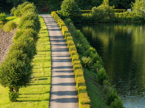
After approx. 6 kilometers, the circular route turns right down to the dam of the Große Dhünn reservoir with a magnificent view of the water surface in three directions. Rest areas invite you to linger. The path now leads you over the dam to the north bank, where you first have to circle a steep slope. The rock for building the dam was taken from the mountain here.
Once back on the bank, you will now experience completely new perspectives of the dam with a constant view of the water surface. The water level of the pre-dam is kept at a constant level, creating the impression of a natural lake with dense shoreline vegetation. However, the protective forest planted when the dam was built has now been heavily thinned out, as violent storms have brought down many a tree. A new, natural protective forest of native tree species is now forming on open areas flooded with light. The path now follows the waterline along the banks of the dam. After the last side valley, the lake becomes narrower; the opposite southern side runs out into a flat shore zone. A biotope was created here as part of the construction of the Große Dhünn-Talsperre, which is now a refuge for a wide variety of flora and fauna. With a bit of luck, you may even spot a kingfisher here! After a few meters, a final bend to the right leads you back to the L409 and the hiking parking lot.


